Everyday life
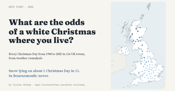
What are the odds of a white Christmas?
Christmas Day snow at 116 UK towns since 1940: snow lay in about 1 Christmas in 11, from never in Bournemouth to most years in the Highlands.
Interactive studies of the past, places, politics, everyday life and the weather, in Britain, across Europe and around the world, built from open data. Search your town, drag a slider, switch a layer. Every study has a write-up on the blog and its data and code on GitHub and Zenodo.
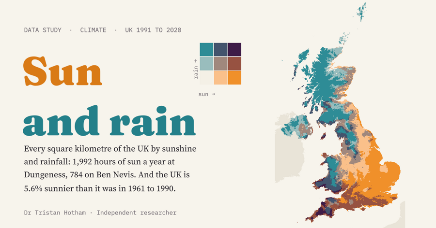 UKSun and Rain: the UK5.6%sunnier and 7.2% wetter since 1961 to 1990
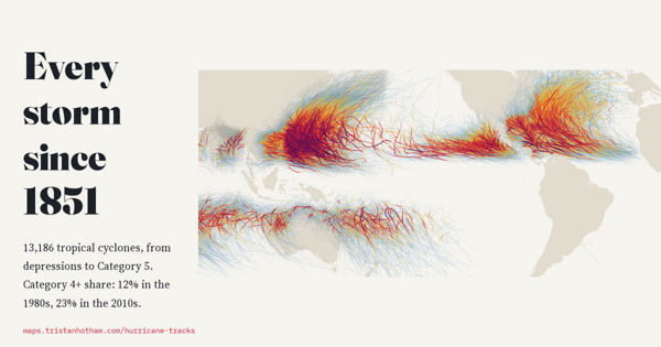 WorldEvery Storm Since 1851Since 1980the rising share reaching Category 4 or 5
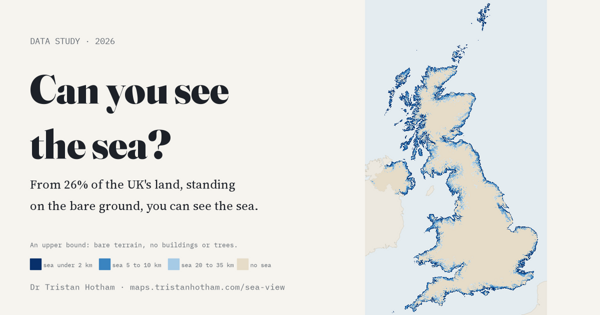 UKCan you see the sea?26%of the land has a sea view from the ground
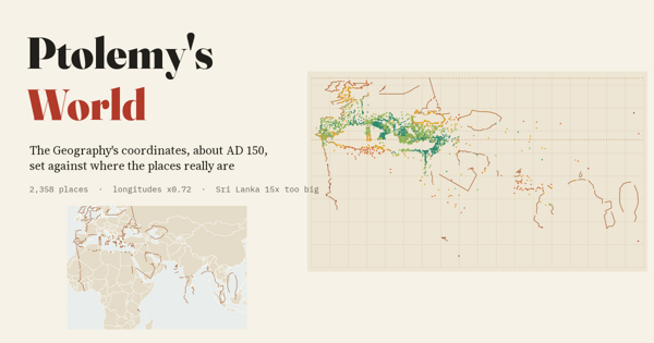 WorldPtolemy's World, Measured2,358of Ptolemy's places set against where they really are
Christmas Day snow at 116 UK towns since 1940: snow lay in about 1 Christmas in 11, from never in Bournemouth to most years in the Highlands.
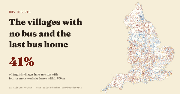
41% of English villages have no usable weekday bus within 800 m, and 68% no Sunday bus nearby.
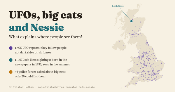
What explains where people see them? UFO reports, police big cat records and the Loch Ness sightings register, tested.
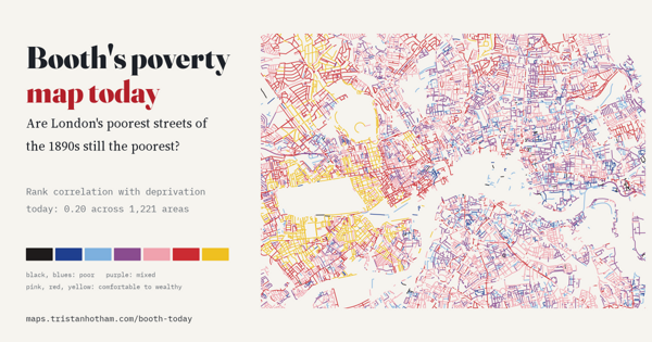
Are London's poorest streets of the 1890s still the poorest? Booth's colours read street by street against today's deprivation.
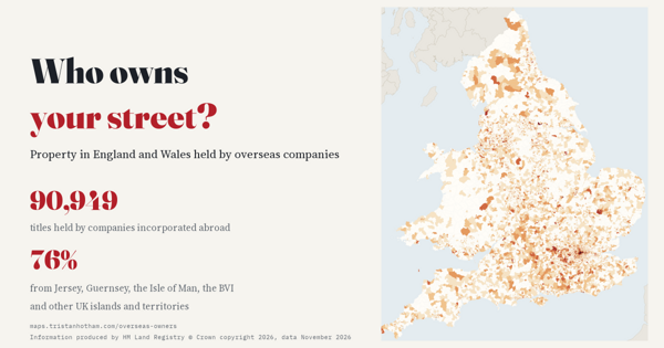
Property in England and Wales held by overseas companies, by small area: 90,949 titles, 76% via Crown Dependencies and Overseas Territories.
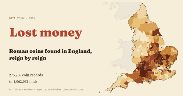
Roman coins found in England, reign by reign: 275,206 Portable Antiquities Scheme records by district.
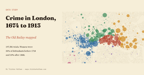
The Old Bailey Proceedings mapped: from the gallows and transportation to prison, and where London's crimes happened.
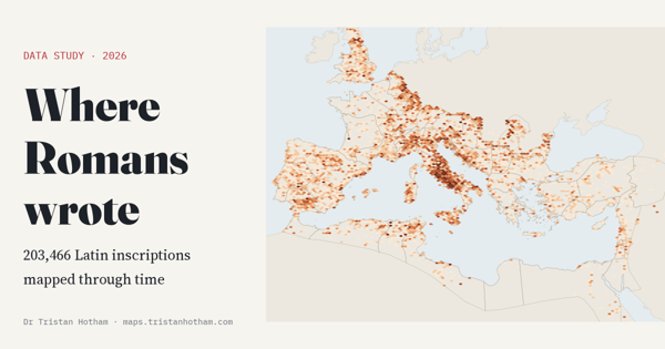
200,000 Latin inscriptions mapped across the Roman Empire: the epigraphic habit, ages on tombstones and soldiers far from home.
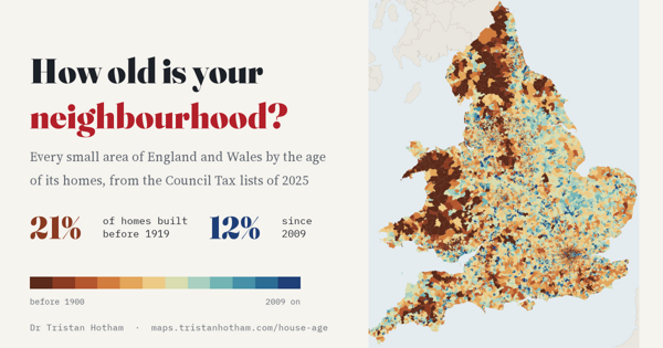
The age of the homes in every small area of England and Wales: 21% predate 1919, and cities grow in rings.
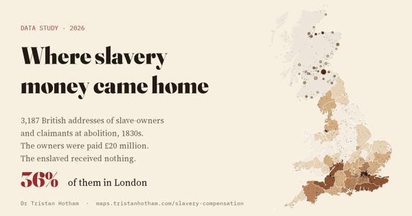
3,187 British addresses of slave-owners and claimants compensated in the 1830s: 36% in London.
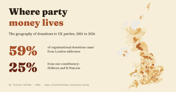
Organisational donations to UK parties since 2001 by donor address: 59% from London, and a quarter from one constituency.
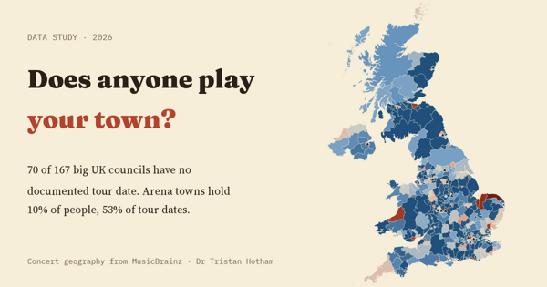
Every UK concert documented in MusicBrainz, 1960 to 2025, by council area: arena towns hold 10% of people but 53% of documented tour dates.
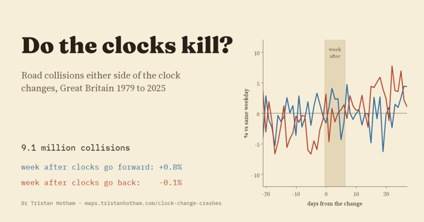
Road collisions in the week after the clocks change, Great Britain 1979 to 2025: no jump in spring or autumn across 9.1 million collisions.
Sight lines from every 1 km square of the UK: 26% of the land has a sea view from the ground.
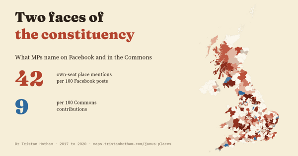
How often MPs name the places they represent: 42 times per 100 Facebook posts, 9 per 100 Commons speeches.
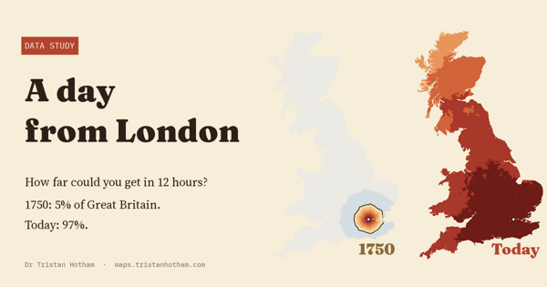
How far a traveller leaving London at dawn could get in a day in 1750, the 1830s, 1850, 1910 and today: from about 5% of Great Britain's land to almost all of it.
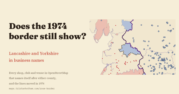
Lancashire and Yorkshire in business names: where the old line did not move, it is still sharp, and the Lancashire name thins out in Greater Manchester and Merseyside.
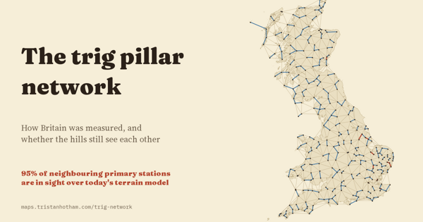
How Britain was measured: 6,573 OS trig pillars, and 95% of the lines between neighbouring primary stations still clear on a terrain model.
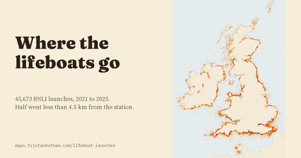
Five years of RNLI launches mapped: half go less than 4.5 km from the station, and all-weather boats go about two and a half times further than inshore boats.
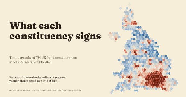
Signatures by constituency for 734 UK Parliament petitions: every petition's map is clustered, and two broad signing profiles run through the seats.
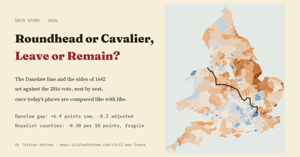
Did the Danelaw or the Civil War leave a trace in the 2016 vote? Once demography is held equal, Danelaw seats voted much like the rest of England.
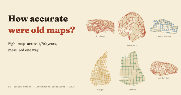
Eight maps from Ptolemy to Ino Tadataka, re-fitted one way: median error from 26% of the mapped area on the Peutinger Table to under 2% on Ino's survey of Japan.
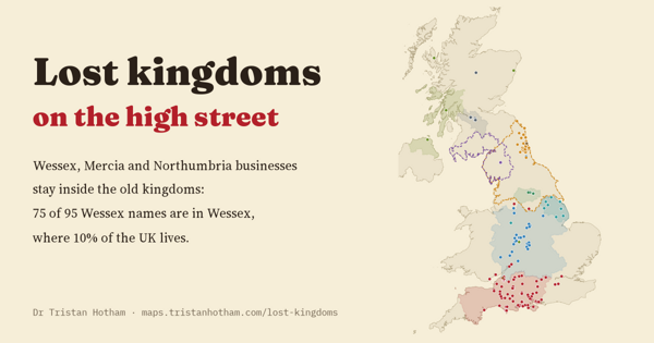
Businesses named after Wessex, Mercia and Northumbria still cluster inside the old kingdoms: 75 of 95 Wessex names are in Wessex.
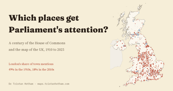
A century of Commons mentions of 1,596 UK towns: London's share fell from 49% in the 1910s to 18% in the 2010s, and towns named in a seat's title get about twice the mentions.
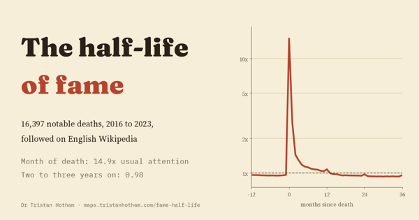
16,397 notable deaths on English Wikipedia: attention jumps about 15-fold in the month of a death and is back near its old level within two years.
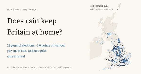
Rain while the polls were open at 22 UK general elections since 1945: turnout about a tenth of a point lower per millimetre, but not established.
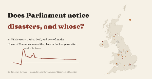
64 UK disasters, 1910 to 2020: the Commons names the place about 10 times as often in the month of a disaster, and most of that fades within the year.
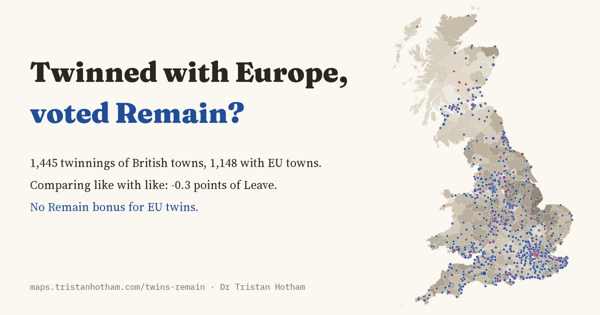
1,445 British town twinnings against the 2016 vote: places twinned with Europe voted about the same as similar places.
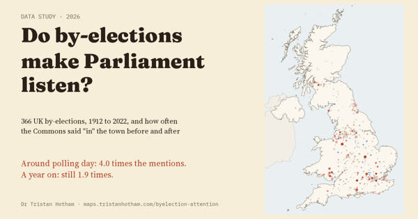
366 UK by-elections and a century of Hansard: the town gets about four times the Commons mentions around polling day, and more for two years.
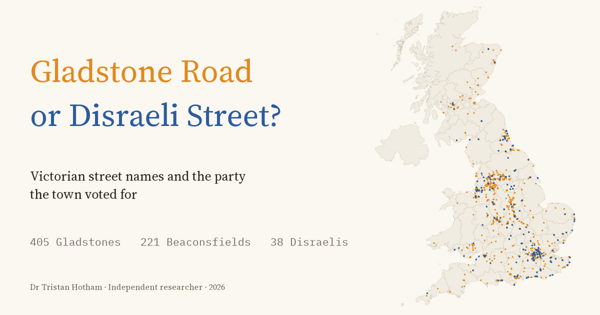
Every Victorian statesman's street in Britain, set against how 160 towns voted, 1868 to 1900: Liberal names everywhere, a little more in Liberal towns.
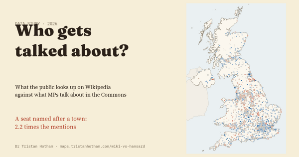
Wikipedia reading against Commons debate for 1,425 UK towns: a seat named after a place goes with 2.2 times the mentions.
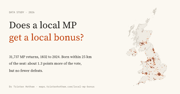
31,737 MP returns since 1832: MPs born within 25 km of their seat win about 1.3 points more of the vote, but are defeated just as often.
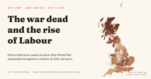
First World War memorial names against every election from 1906 to 1924: places that lost more men swung less to Labour in 1918, not more. A suggestive, pre-planned test.
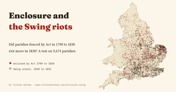
Every enclosure Act linked to 9,674 parishes in a pre-planned test: enclosed parishes rioted 2.7 points more in 1830, but no more than other parishes of the same size.
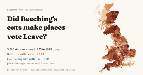
3,206 stations closed from 1955 to 1975. Seats that lost more voted Leave more, but compared with similar seats the link vanishes: a well-powered null.
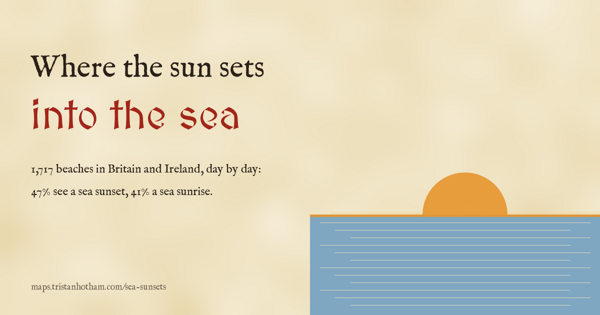
1,717 beaches in Britain and Ireland, day by day: 47% see a sunset into open sea on some day of the year, only 52 every day, and Arran hides 134 sunsets a year from Troon.
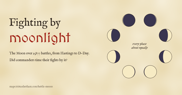
The Moon over 9,877 dated battles, with calendars corrected: they fall on every phase almost equally, and D-Day's bright Moon was the exception, not the rule.
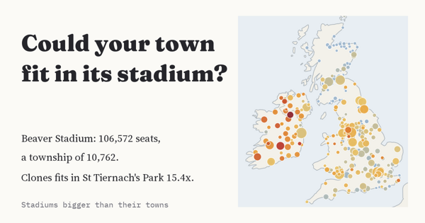
190 sports grounds hold more people than their town: GCS Ballpark seats Sauget 42.5 times over, St Tiernach's Park seats Clones 15.4 times, and Turf Moor holds 27% of Burnley.
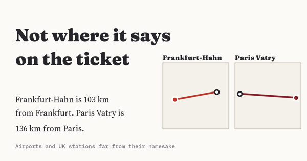
4,448 airports and 2,888 UK stations measured against the place in their name: Paris Vatry is 136 km from Paris, Frankfurt-Hahn 103 km, and Tiverton Parkway 9 km from Tiverton.
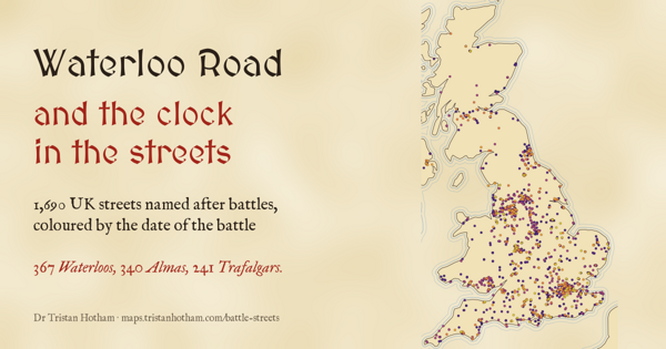
1,690 UK streets named after battles from 1793 to 1944: 367 Waterloos and 340 Almas, and in 53 of 75 towns the later battles lie farther from the centre.
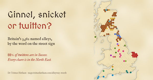
3,382 named alleys on UK street signs by their word: 88% of twittens are in Sussex, every chare is in the North East, and London's 375 named alleys use a regional word just twice.
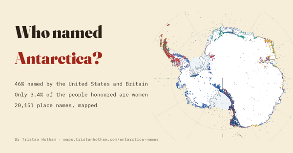
20,151 Antarctic place names by who named them, when and after whom: the US named 26% and the UK 20%, and only 3.4% of the people honoured are women.
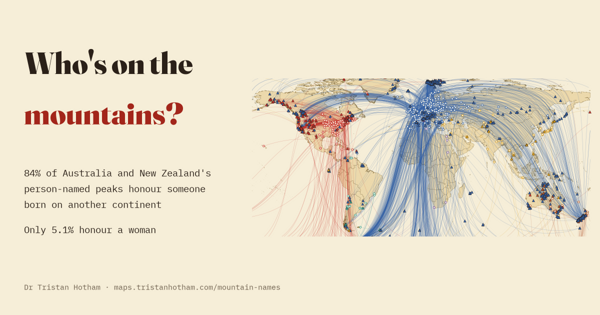
2,228 mountains named after people, linked to where those people were born: 84% of the person-named peaks of Australia and New Zealand honour someone born on another continent.
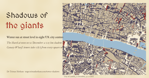
Winter sun at street level in eight UK city centres: on the shortest day the Shard's noon shadow is about 1.1 km long, and Canary Wharf's towers take 0.76 hours of sun from every square metre.
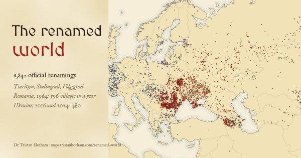
6,842 official renamings of places in Wikidata, by decade and by why: revolution, its undoing, war and nation-building. The busiest year was Romania's 1964.
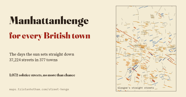
The days the sun rises or sets straight down 37,224 streets in 377 UK towns: 1,072 line up with a solstice, about as many as chance, and Midsummer Boulevard misses midsummer.
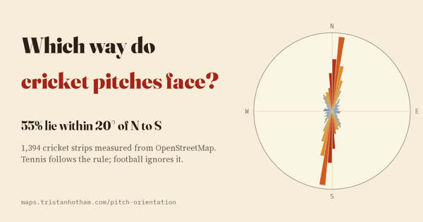
Cricket strips in OpenStreetMap: 55% of the world's 1,394 run within 20 degrees of north to south, out of the low sun. Tennis follows the rule; football points anywhere.
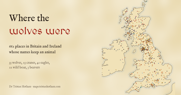
662 places in Britain and Ireland named after animals, checked by hand: wolf names sit high in the hills, at a median 256 m against 103 m for similar names.
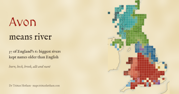
32,068 named UK rivers and streams: 37 of England's 60 biggest rivers kept names older than English, and the Norse beck still marks where Vikings settled.
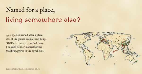
2,901 species named after places, tested against GBIF records: 98% are recorded in their namesake's country, but the coco de mer, named for the Maldives, grows in the Seychelles.
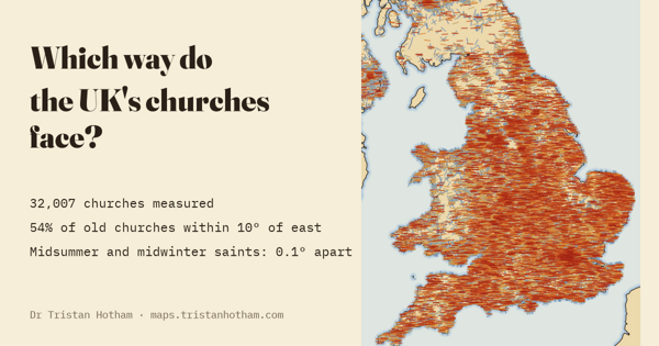
32,007 church axes from OpenStreetMap: old churches face east, later ones follow the street, and the patron saint's sunrise makes no difference.
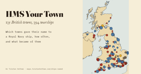
394 Royal Navy warships named after 135 British towns: Gloucester and Newcastle have had nine each, and the habit has come and gone for 350 years.
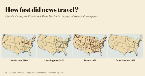
Lincoln, Custer, the Titanic and Pearl Harbor in 936 American newspapers: dailies printed all but Custer the next day; the weekly press day was the real delay.
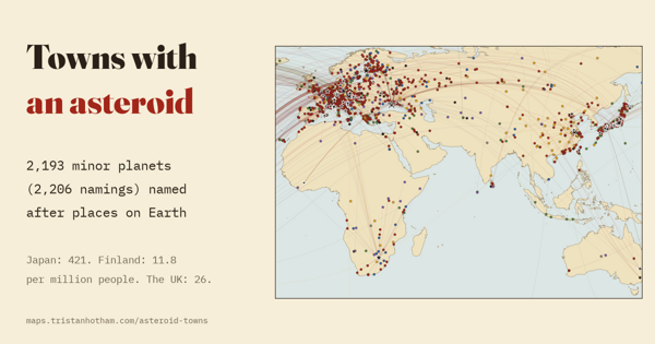
2,193 asteroids named after places on Earth, each linked to the observatory that found it: Japan has the most, Finland the most per head.
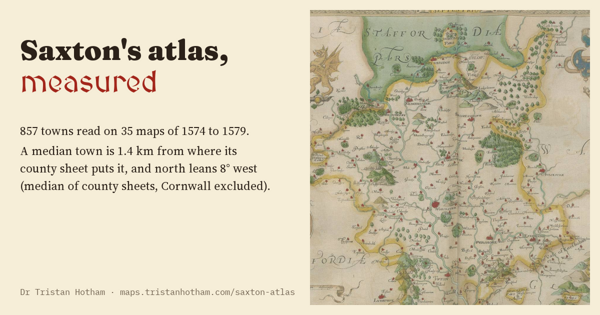
857 towns read on Saxton's maps of 1574 to 1579: a typical town is 1.4 km out, and north leans west by about 8 degrees, like a compass.
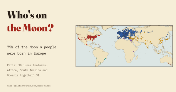
The Earth birthplaces of the 2,718 people with features on the Moon, Mercury, Venus and Mars: 75% of the Moon's were born in Europe.
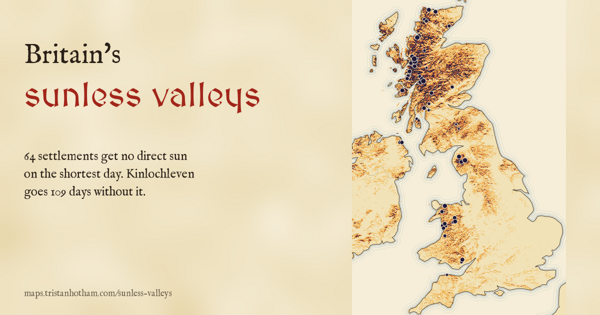
Skylines for 36,692 UK settlements: 64 get no direct sun on the winter solstice, and Camas-luinie goes 123 days without it.
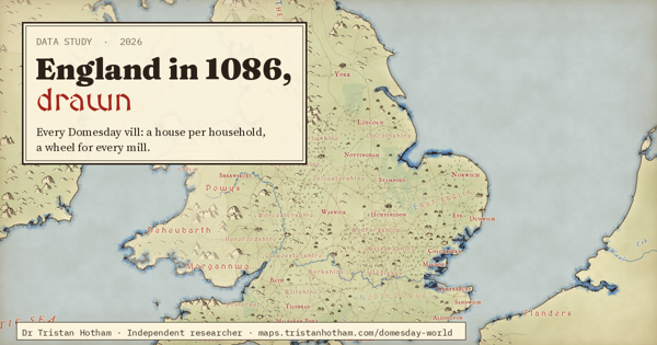
Every vill in Domesday Book on a hand-inked map: one house per household, a water wheel for every mill on its stream, 71,419 plough teams, and walled York, London and Winchester.
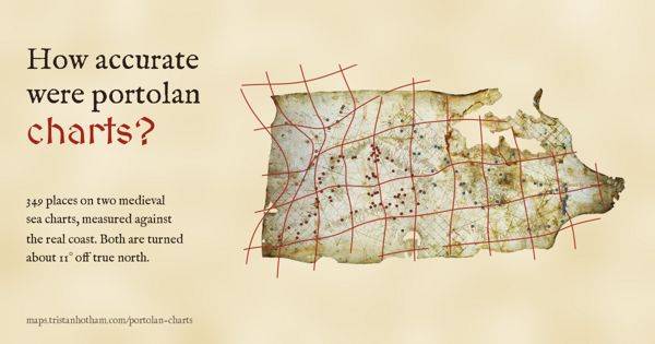
349 places read on the Carta Pisana and the Catalan Atlas: both turned about 11 degrees off north, the Mediterranean within a few dozen kilometres, the Atlantic shrunk and misplaced.
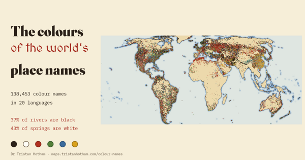
138,453 places named black, white, red, green, blue or yellow in 20 languages: rivers run black, springs run white, and Cerro Colorado is the commonest colour name on Earth.
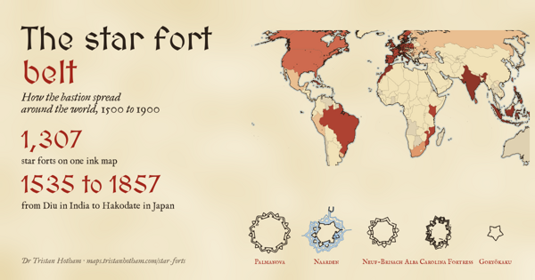
1,307 bastioned forts drawn by their real outlines: the star fort did not creep out of Italy, it sailed, reaching India, Morocco and the Caribbean as early as Germany and England.
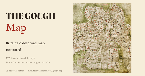
157 towns found on a map of Britain drawn about 1360: a typical town is 18 km out of place and Wales is blown up, yet 72% of the miles written on its roads are within 25% of the real road.
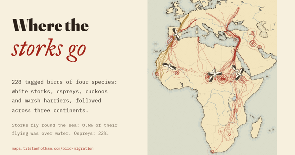
228 tagged birds across three continents: young storks fly 0.6% of their distance over the sea and squeeze through Gibraltar and the Bosporus, while ospreys and cuckoos cross open water.
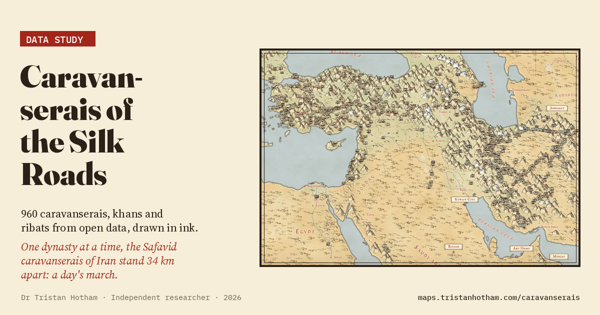
960 caravanserais, khans and ribats on a hand-inked map: all together they crowd closer than a day's march, but the Safavid inns of Iran stand a median 34 km apart.
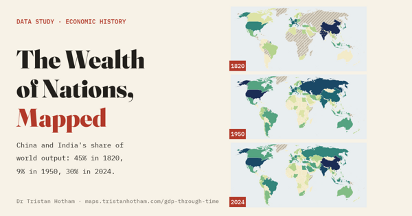
The world economy on one playable map from 10,000 BC to 2024: China and India made 45% of world output in 1820, 9% in 1950 and 30% today.
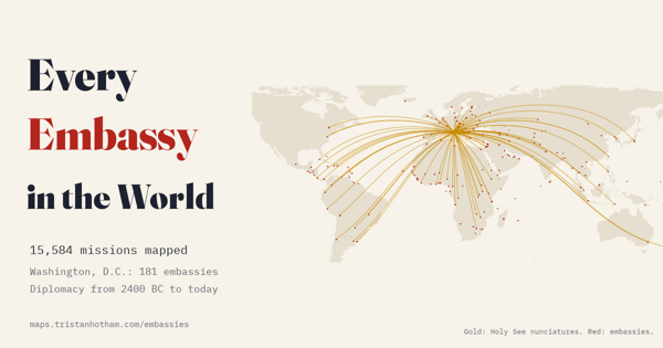
15,584 embassies, consulates and missions from open data: Washington hosts 181 embassies, the Holy See runs 88 nunciatures, and the diplomatic web traced from the Amarna letters to today.
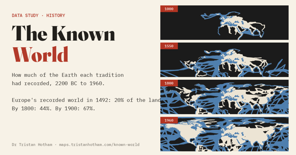
681 journeys from the Bronze Age to 1960 light up a dark world: Europe had recorded 20% of the land in 1492 and 67% by 1900, and much of the dark was known first to China, the Islamic world or Polynesian voyagers.
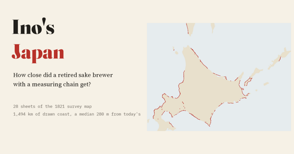
Ino Tadataka's 1821 survey of Japan's far north laid on today's coast: the drawn coastline sits a median 280 m from the modern line.
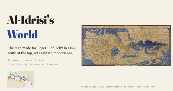
The map made for Roger II of Sicily in 1154, south at the top, measured on 431 towns: directions right to a median 10 degrees, and Sicily drawn best.
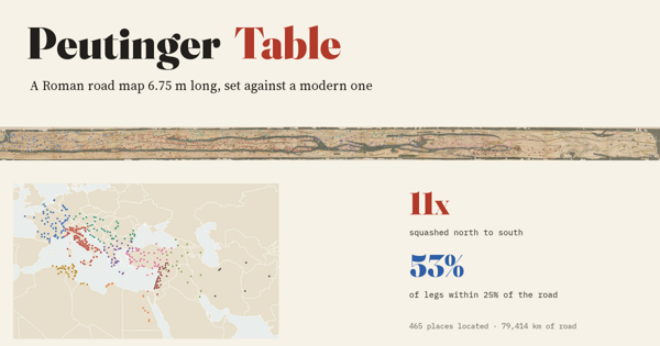
A Roman road map 6.75 m long beside a modern one: it squashes the world 11 times north to south, yet most of its road distances are close to the real road.
2,358 of Ptolemy's places set against where they really are: shrink his longitudes by 0.72 and the map falls into place, but Scotland is turned on its side.
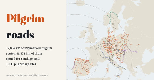
77,804 km of waymarked pilgrim routes: more than half lead to Santiago, and there is more of the Way of St James in Germany than in Spain.
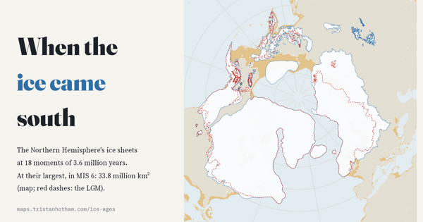
The Northern Hemisphere's ice sheets at 18 moments of the last 3.6 million years. The last ice age was only the fourth largest.
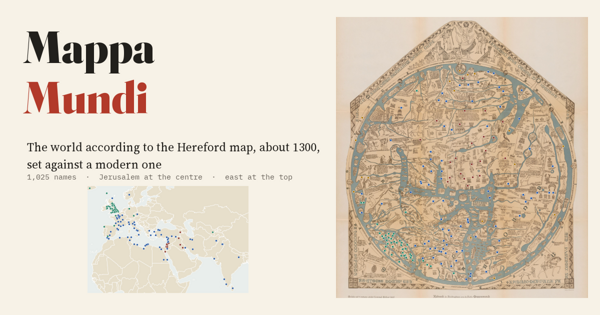
The largest surviving medieval world map set beside a modern one: its directions from Jerusalem are mostly right, but the Holy Land is drawn 4.5 times too big.
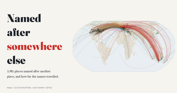
3,981 places named after another place: most names come from a river or the town next door, 14% crossed an ocean, and Britain gave away the most.
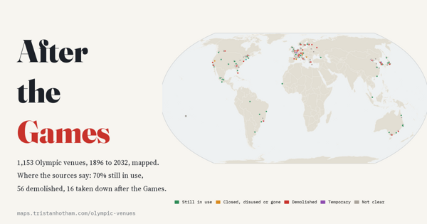
All 1,153 Olympic venues from Athens 1896 to Brisbane 2032: 88 served more than one Games, and where the sources say, 70% are still in use.
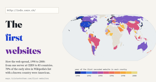
From one server at CERN to 83 countries by 2000: 2,327 early websites mapped. The web began with physicists and was soon overwhelmingly American.
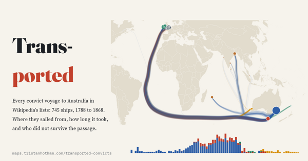
Every convict ship voyage to Australia, 1788 to 1868: the busiest port was Cork and the Second Fleet lost a quarter at sea.
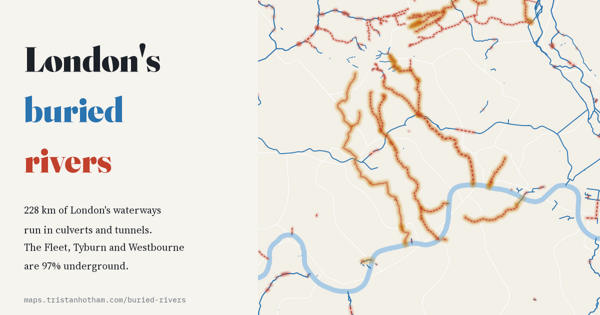
What still flows in the open and what runs in the dark: the Tyburn, Westbourne and Fleet are almost wholly underground.
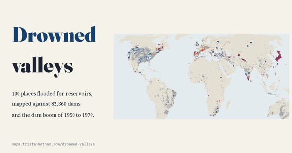
The villages and valleys flooded for reservoirs, from Capel Celyn to Mologa, set against the great dam-building boom.
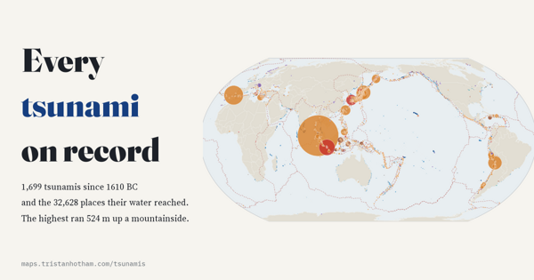
Every recorded tsunami since 1610 BC and the places its water reached: most start with an earthquake, the highest ran 524 m uphill.
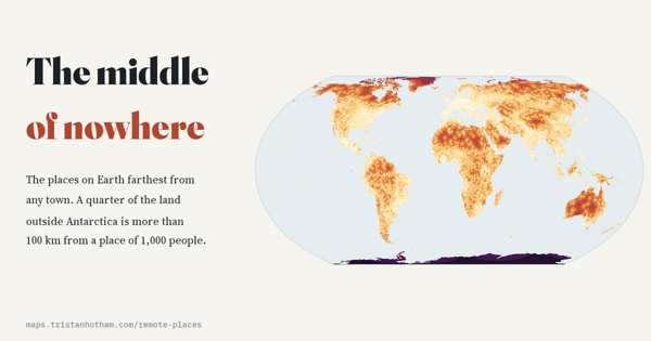
How far every point on land is from the nearest town: a quarter of the land outside Antarctica is more than 100 km from one.
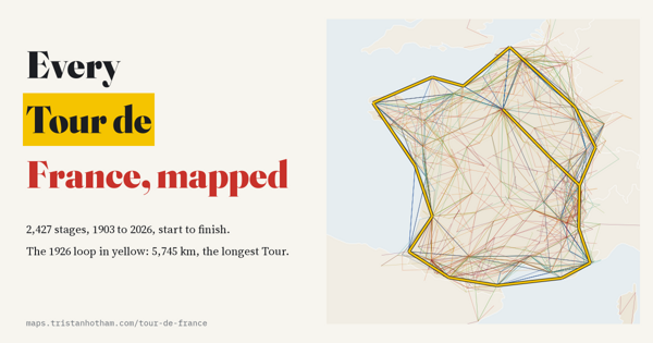
Every stage since 1903: from one unbroken lap of France's edges to a race that hops, shorter and faster than ever.
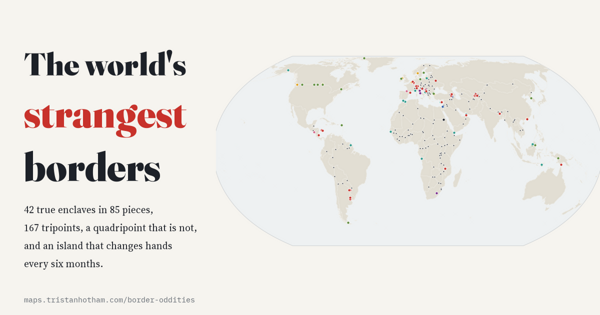
Every enclave, exclave and tripoint: 42 true enclaves in 85 pieces, and a front door split between two countries.
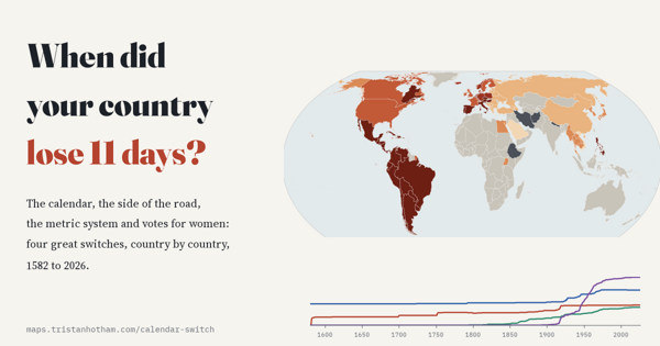
The Gregorian calendar, driving side, metric units and votes for women, switched country by country.
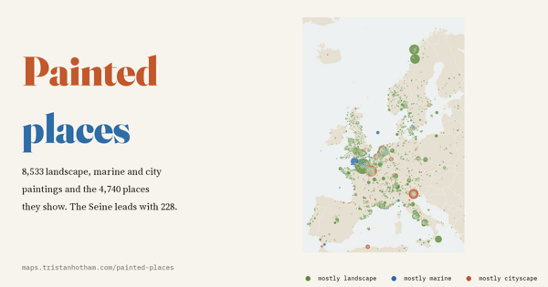
Where landscape painters painted: the most painted place on Earth is a river, the Seine, and how far painters went from home.
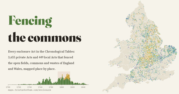
Every parliamentary enclosure Act in England and Wales mapped place by place: two waves, and half passed in the wars with France.
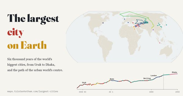
Six thousand years of the world's biggest city, from Uruk to Jakarta, and how the centre of the urban world wandered.
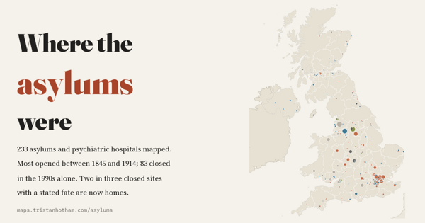
Britain's asylums mapped: most built between 1845 and 1914, almost none closed until the 1980s, and most closed sites are now homes.
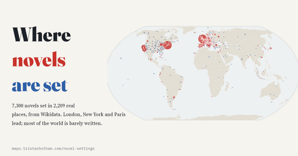
The real settings of 7,300 novels: London, New York and Paris dominate, and most authors stay close to where they were born.
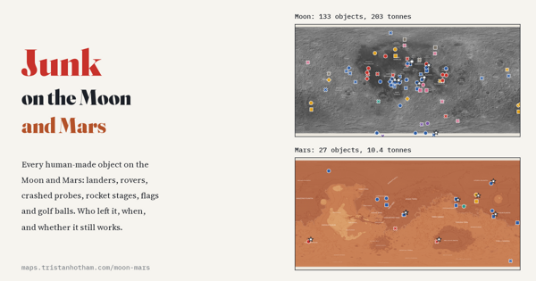
Every human-made object on two worlds: 133 on the Moon and 27 on Mars, from landers and rovers to golf balls.
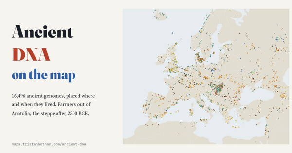
16,496 ancient genomes placed where and when they lived: the first farmers spread out of Anatolia at about a kilometre a year.
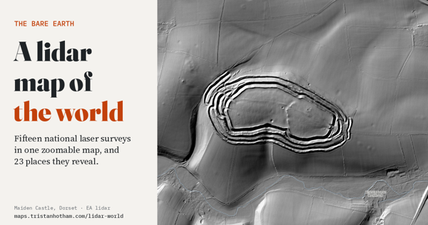
Fifteen national lidar surveys in one zoomable map: the ground with the trees and buildings taken away. Hillforts in forests, the craters of Verdun and Messines, Roman gold mines and Japan's largest burial mound.
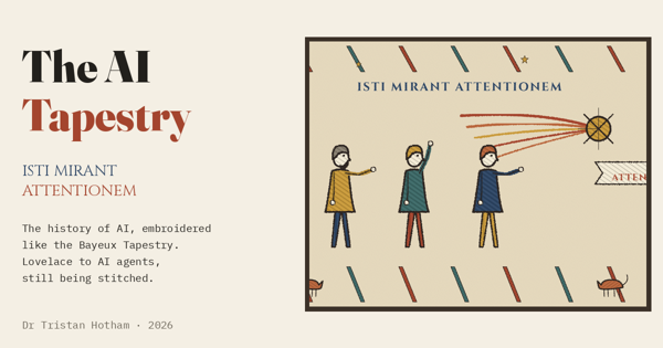
The history of artificial intelligence stitched like the Bayeux Tapestry: from Ada Lovelace's engine to AI agents, with Latin captions, two winters, a comet called attention and a sourced note behind every scene.
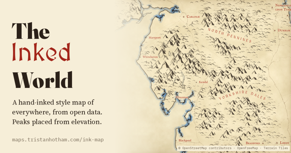
The whole Earth drawn like a hand-inked fantasy map: peaks only on real high ground, dunes for deserts, castles, town walls and great landmarks in pictures, rivers and beaches named in blue, and towns of tiny red and blue roofed houses packed tightest at the centre.
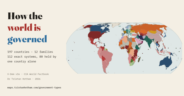
197 systems of government compared on eight features: 12 families, 112 exact systems, and 80 countries with a system no one else shares.
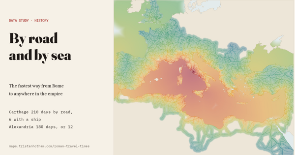
Fastest travel from Rome with ships as well as roads: Carthage was 210 days' walk by road and 6 with a ship, from Casson's ancient voyage speeds.
Every hurricane, typhoon and cyclone in the global best-track archive: where storms form and hit, and the rising share reaching Category 4 or 5 since 1980.
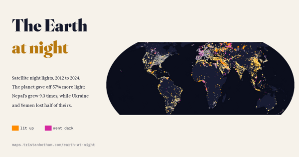
Satellite night lights 2012 to 2024: 57% more light, Nepal up ninefold, Ukraine and Yemen half dark, and why LEDs fool the satellite.
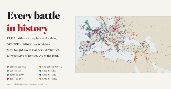
13,712 battles from 3001 BCE to 2026: the most fought-over places, how war moved across the world, and the bias in the record.
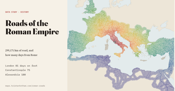
299,171 km of Roman road and a travel model: London was 81 days on foot from Rome, Constantinople 75 and Alexandria 180.
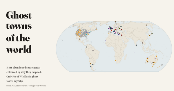
5,448 abandoned settlements coloured by why they were left, and what open data does not record.
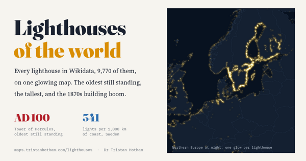
9,770 lighthouses on one glowing map: lights per km of coast, when they were built, the oldest still standing and the tallest.
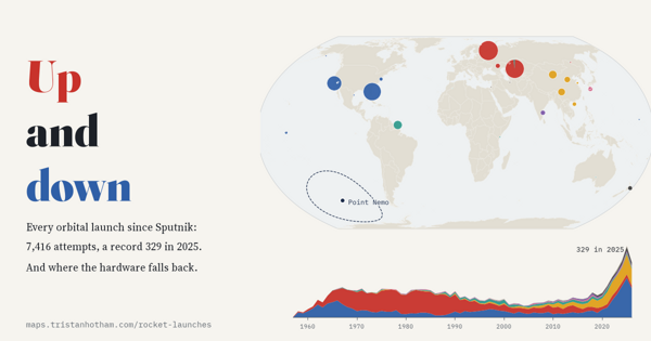
7,416 orbital launches since 1957: the space race, the record 329 of 2025, the busiest spaceports and the Point Nemo spacecraft cemetery.
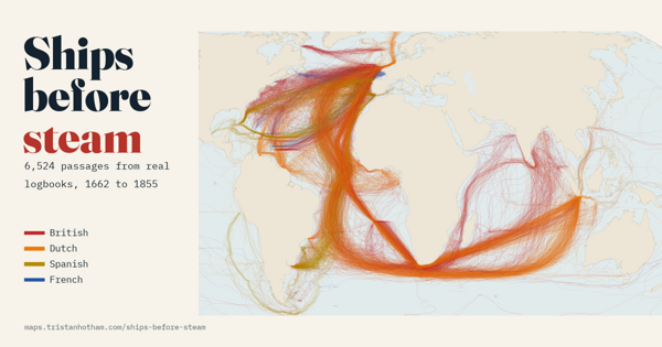
Real ships' logbooks from 1750 to 1850 drawn as voyage lines: the trade winds, the volta do mar, the Brouwer route and how long voyages took.
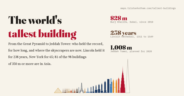
Every record holder from the Great Pyramid to Jeddah Tower: Lincoln Cathedral held the title for 238 years, New York for 65.
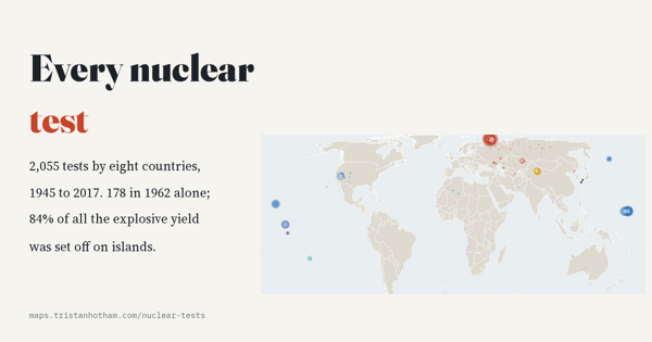
2,055 nuclear tests by eight countries since 1945: the 1962 peak, the move underground, and whose land they were on.
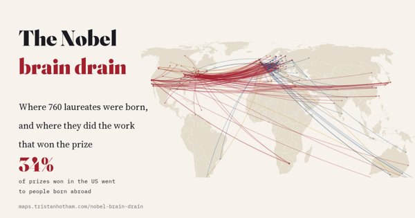
Nobel laureates from birthplace to prize: the US as the great importer, Germany after 1933, Japan's rise and the top universities.
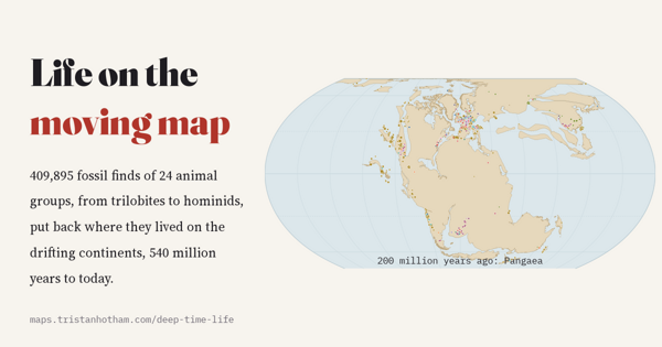
540 million years of drifting continents, from Pangaea onwards, with fossil animals from trilobites to dinosaurs where they lived.
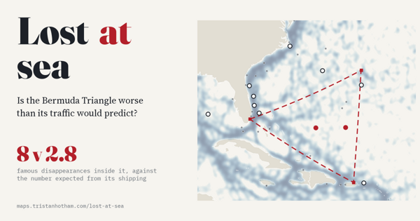
472 famous disappearances at sea tested against shipping traffic: the Bermuda Triangle is no worse than its neighbours.
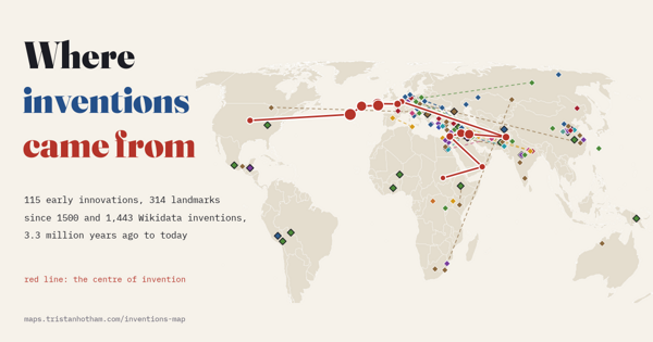
Where inventions came from over 3.3 million years: independent origins, the moving centre of invention, inventive cities and who gets the credit.
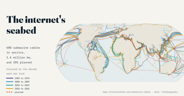
Every submarine internet cable: when each was laid, who owns them, and the straits and hubs where they crowd together.
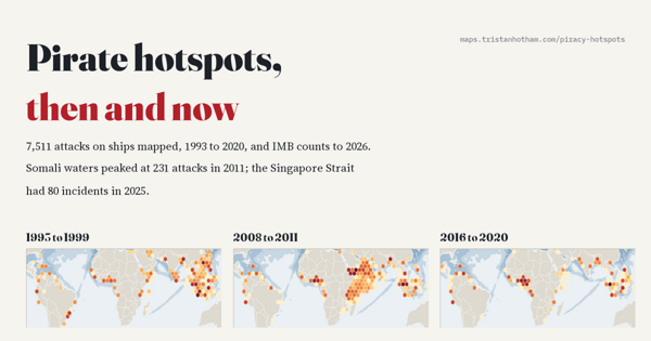
7,511 pirate attacks from 1993 to 2020, with IMB counts to 2026: piracy moved from the Strait of Malacca to Somalia, the Gulf of Guinea and now the Singapore Strait.
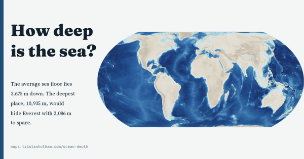
The whole ocean floor in depth: the average sea floor lies 3,675 m down, 74% of it is abyssal, and only 28.7% is mapped to modern standards.
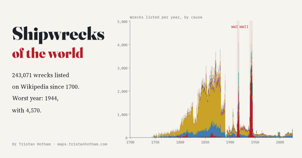
243,071 wrecks listed on Wikipedia since 1700, year by year: three of the five worst years are war years, with 1944 the worst of all.
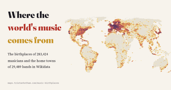
Birthplaces of 283,424 musicians and home towns of 29,489 bands: New York, London, Paris and Vienna lead, and Finland has the most metal bands per head.
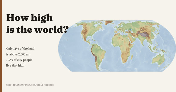
The height of the whole planet on one map: the land averages 807 m, only 11% of it is above 2,000 m, and only 1.9% of city dwellers live that high.
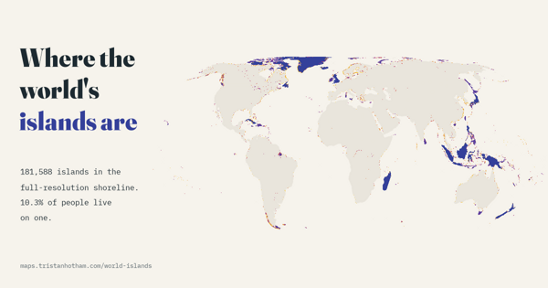
181,588 islands in a detailed open shoreline map, 23,150 over a square kilometre. Canada has the most, and 10.3% of the world's people live on one.
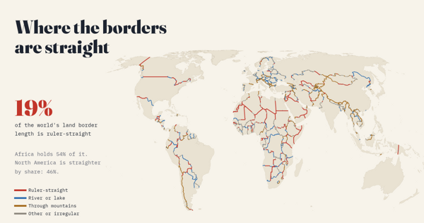
19% of the world's land borders are ruler-straight and Africa holds over half of that length, but North America is straighter by share. With the treaties behind the 40 longest lines.
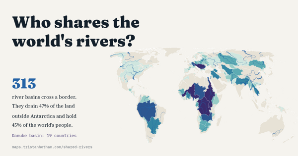
313 river basins cross a border, draining 47% of the land outside Antarctica and holding 45% of the world's people. Plus the great rivers measured on one map.
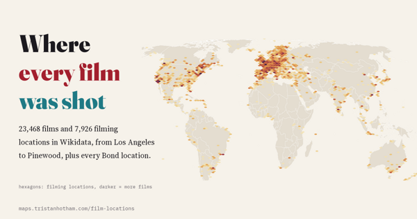
Filming locations of 23,468 films in Wikidata: Los Angeles, New York, London and Paris lead, Canada hosts the most foreign productions, and the Bond films reached 36 countries and territories.
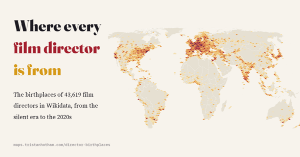
Birthplaces of 43,619 film directors: New York and Paris lead, Prague and Copenhagen lead per head, and women rose from 3% of new directors in the 1920s to 32% in the 2020s.
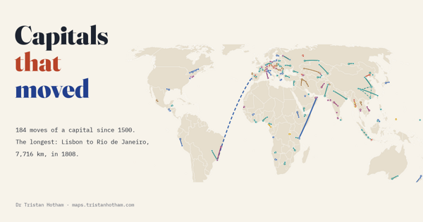
184 capital moves since 1500, checked by hand. The longest was the Portuguese court's flight from Lisbon to Rio de Janeiro in 1808: 7,716 km.
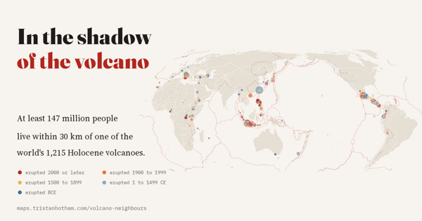
All 1,215 Holocene volcanoes and their neighbours: at least 147 million people live within 30 km of one, and 76 volcanoes have a million or more.
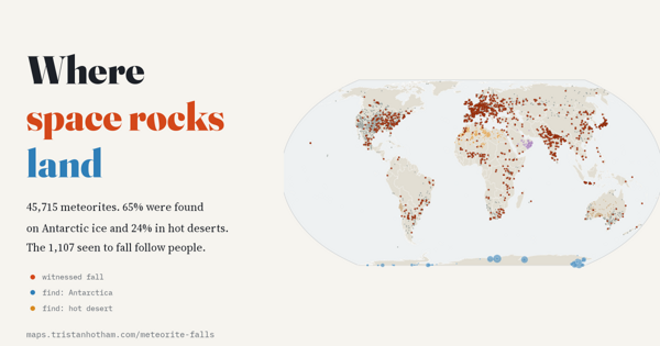
45,715 meteorites: 65% found on Antarctic ice and 24% in hot deserts, while the 1,107 seen to fall follow people, not the sky.
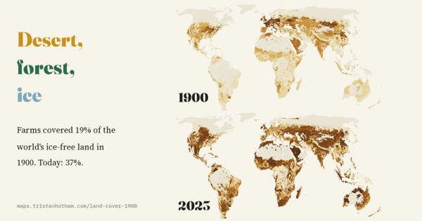
The world's land in 1900 and now: farms covered 19% of the ice-free land in 1900 and cover 37% today. Where the new fields came from, and where trees came back.
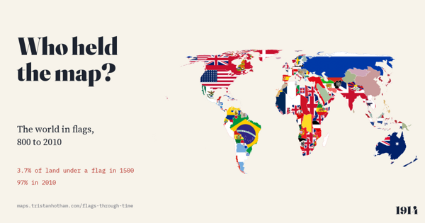
Twelve centuries of the world map, 800 to 2010, each piece of land filled with the flag of whoever held it. In 1000 no land can honestly be shown with a flag; by 2010, 97% can.
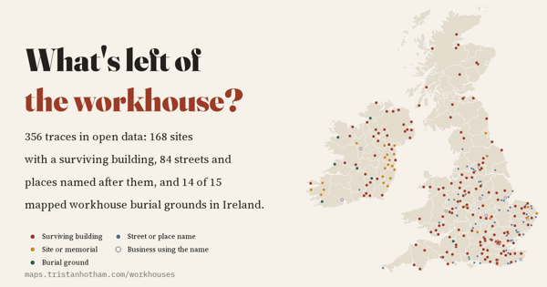
356 traces of Britain and Ireland's workhouses in open data: surviving buildings, Workhouse Lanes and famine graves. 74% of survivors with a known later use became hospitals or homes.
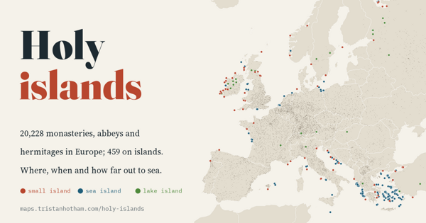
20,228 European monasteries and hermitages checked against the shoreline: before 800, 4.3% stood on islands, from Skellig Michael to Iona; after 1100, about one in a hundred.
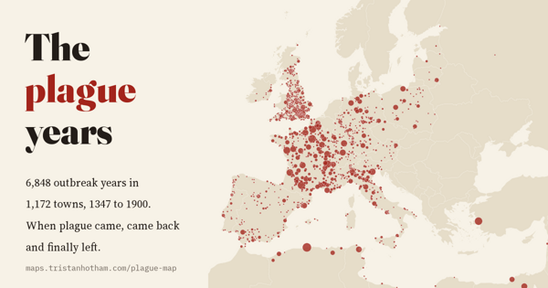
6,848 recorded plague years in 1,172 towns, 1347 to 1900: the Black Death's first wave, a return every 13 years or so, and the last outbreaks a century later in the Ottoman Mediterranean.
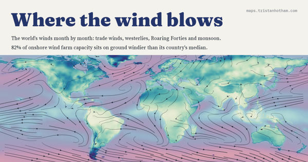
The world's winds month by month, from the trade winds to the Roaring Forties, and 5,344 wind farms: 82% of onshore capacity stands on ground windier than its country's median.
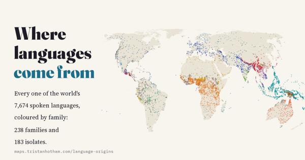
Every one of 7,674 spoken languages with its family tree, endangerment and speakers, plus the proposed homelands of the great families: 421 separate lineages, and 52.1% of languages endangered.
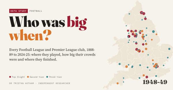
126 seasons of English league football on one map: crowds peaked at 41.2 million in 1948-49, the game moved south, and 39 towns have lost their league club.
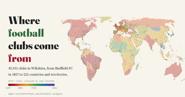
45,931 clubs on an animated map from Sheffield FC in 1857: football spread by sea to Peru and Argentina before Hungary or Russia, and 1919 was the busiest founding year.
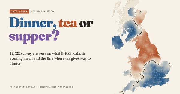
12,522 dialect survey answers on what Britain calls its evening meal: tea in the north, dinner in the south, a tea line through the Midlands, and no sign of dinner moving north.
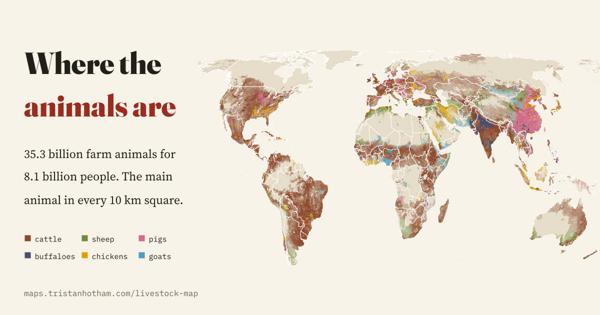
35.3 billion farm animals mapped every 10 km and counted since 1961: chickens have multiplied 7.1 times, and farm mammals outnumber people in 40 countries.
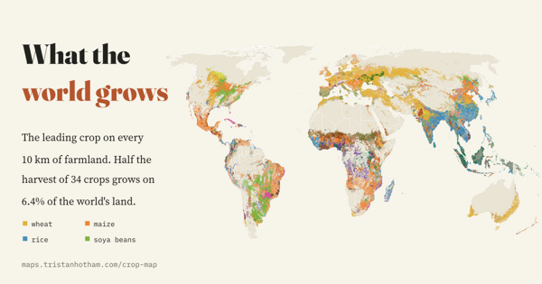
The leading crop on every 10 km square of the world's farmland, and sixty years of change: half the harvest of 34 crops grows on 6.4% of the world's land.
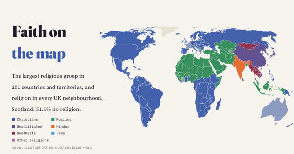
Religion in 201 countries, every UK neighbourhood and 1.6 million places of worship: Christianity's centre has moved to sub-Saharan Africa, and most of Scotland now says no religion.
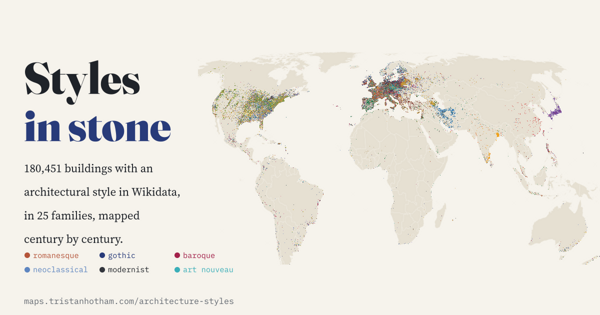
180,451 buildings with an architectural style, sorted into 25 families and mapped century by century: Romanesque gives way to Gothic, Baroque and the revivals, and Gothic Revival sails to Toronto and Melbourne.
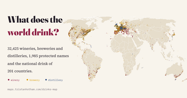
1,985 protected drink names, 32,425 wineries, breweries and distilleries and the national drink of 201 countries: the national drink is often tea.
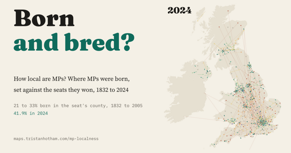
Where 10,094 MPs since 1832 were born, set against the seats they won: for 170 years about a quarter were born in their seat's county, and since 2010 it is 41.9%.
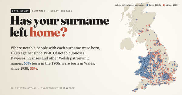
Where 133,761 notable Britons with each surname were born, 1800s against since 1950: Welsh Joneses and Cornish Tre- names are leaving home, though slowly.
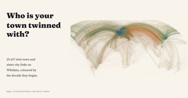
All 29,437 twin town and sister city links on Wikidata as arcs on one map: a post-war European habit that peaked in 1990 and lost dozens of Russian links after 2022.
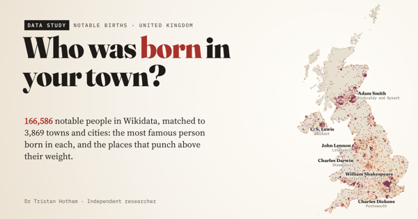
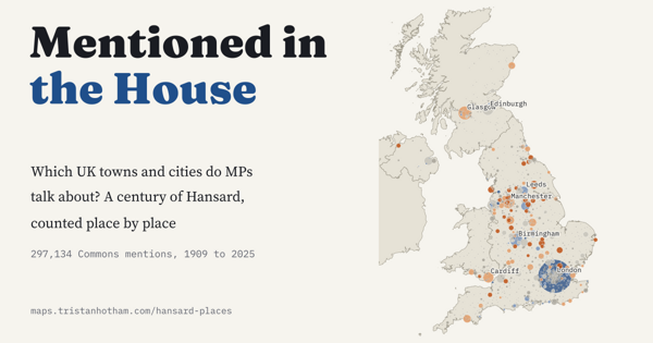
297,134 Commons mentions of UK towns and cities in Hansard since 1909: which places punch above their weight, and who names your constituency.
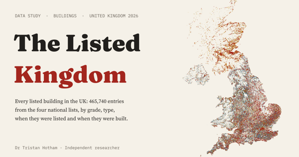
All 465,740 entries on the UK's four lists of listed buildings on one map: mostly Georgian and Victorian houses, with a great many churches at the top.
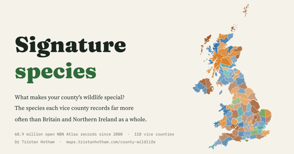
60.9 million open wildlife records sorted into 118 vice counties, to find the species each one records far more often than the rest of Britain and Northern Ireland.
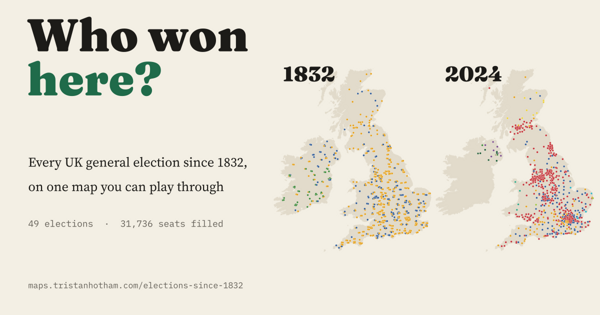
All 49 UK general elections from 1832 to 2024 on one map: 31,736 seats, the forgotten uncontested elections, the Liberal fall and the Red Wall.
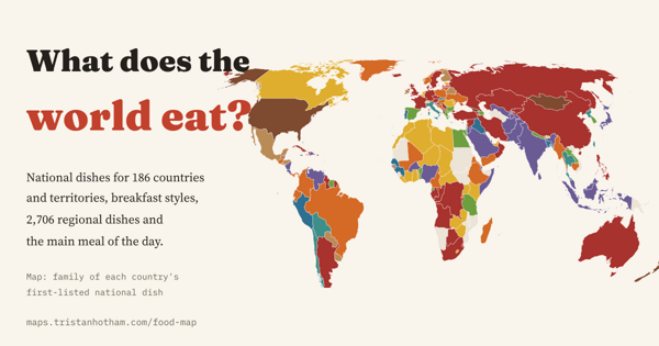
National dishes for 186 countries, breakfasts for 73 and 2,706 regional dishes from fabada in Asturias to takoyaki in Osaka, and why there is no lunch map.
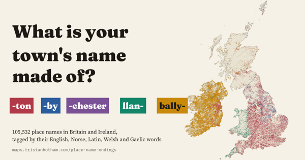
105,532 place names in Britain and Ireland tagged by the English, Norse, Latin, Welsh and Gaelic words inside them: Kil- is a wood far more often than you might think.
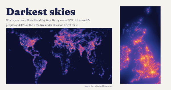
The glow of the world's lights modelled from satellite images and checked against 6,653 sky meter readings: 52% of people, and 85% in the UK, cannot see the Milky Way from home.
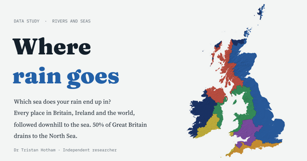
Every place in Britain, Ireland and the world followed downhill to the sea: 50% of Great Britain drains to the North Sea, and 24% of the world's land never reaches the sea at all.
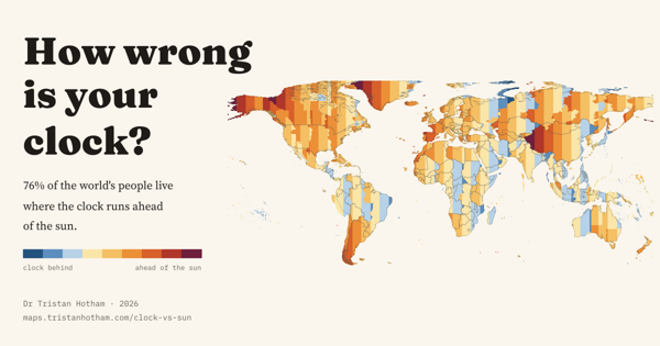
For 76% of the world's people the clock runs ahead of the sun: the gap everywhere, and why winter mornings in Galicia stay dark until after nine.
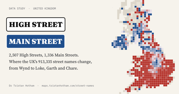
All 913,335 named streets in the UK sorted by name: High Street rules the towns, Main Street the villages of Scotland, Northern Ireland and parts of England.
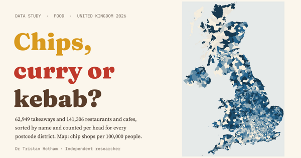
62,949 takeaways and 141,306 restaurants on the food hygiene register sorted by what their names sell: the chip shop capital is the seaside, the curry capital Hounslow.
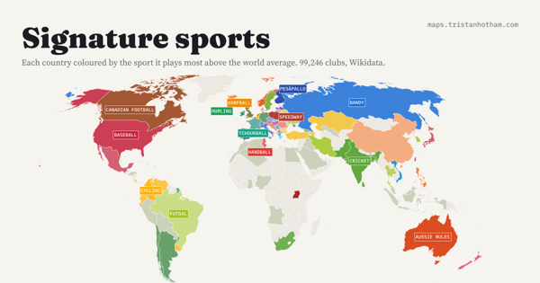
Which sport each country plays far more than the world, from 99,246 clubs: pesäpallo in Finland, tchoukball in Switzerland, hurling in Ireland, speedway in Poland.
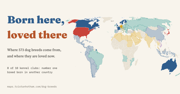
573 dog breeds mapped to their countries of origin and set against kennel club registrations: in 8 of 10 countries the favourite dog was born somewhere else.
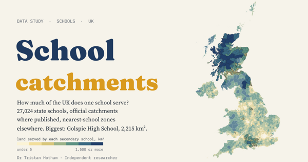
Every one of the UK's 27,024 state schools and how much ground each serves: the biggest catchment, Golspie High School, covers 2,215 km².
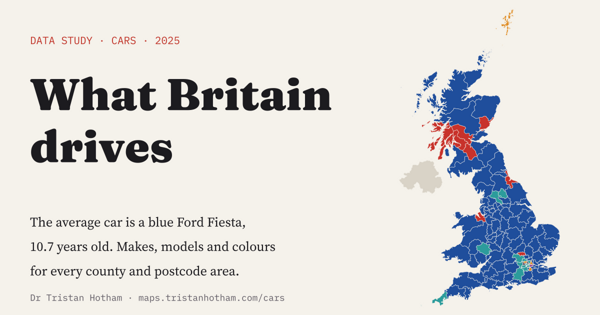
42,728,066 MOT tests mapped by make, model and colour: the average British car is a blue Ford Fiesta, Scotland prefers white, and Shetland loves Toyotas.
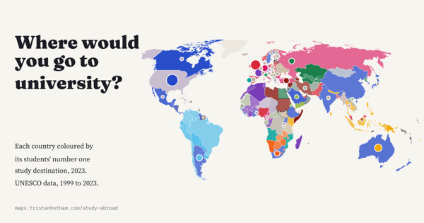
Every country by where its students most often go to study abroad, 1999 to 2023: old empires still show, Turkey is a magnet, and India has overtaken China in Britain.
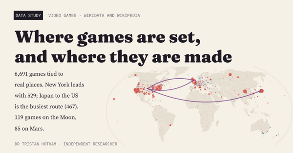
A world map of 6,691 video games tied to real places: New York leads, Japan to the United States is the busiest route from studio to setting, and the Moon beats Mars.
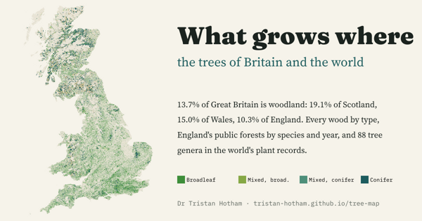
Every wood in Great Britain by type, England's public forests by species and planting year, and 88 tree genera worldwide: woodland covers 13.7% of Great Britain, 19.1% of Scotland but 10.3% of England.
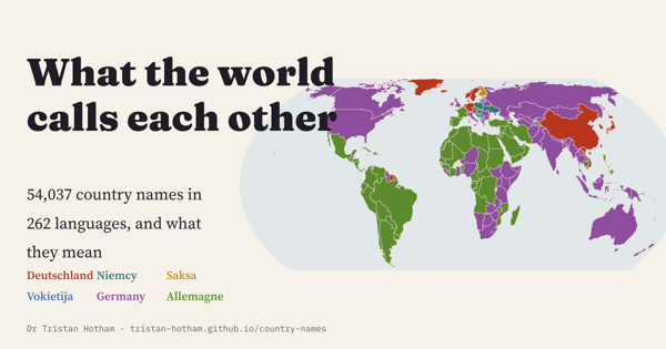
54,037 country names in 262 languages: most countries keep something like their own name everywhere, but Germany has six families of names.
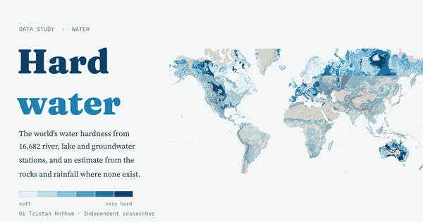
Water hardness from 16,682 river, lake and groundwater stations, and a simple model that guesses it from the rocks: Scandinavia's median is 14 mg/l, the Yucatán's 514.
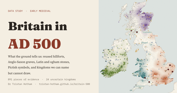
What the ground can place instead of neat kingdoms: 891 pieces of evidence, a sharp east of graves and west of stones, and 24 kingdoms we can name but not draw.
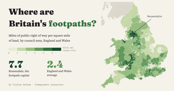
Every council in England and Wales by miles of public footpath per square mile: Rossendale tops it at 7.7, and the South Pennine mill towns fill the top ten.
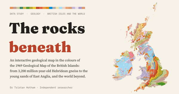
A geological map of the British Isles and the world in the colours of 1969: Carboniferous rocks cover 17.5% of Great Britain, and England's layers get younger all the way to London.
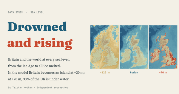
A bathtub model of every sea level from the Ice Age to an ice-free world: Britain becomes an island at −30 m, and at +70 m a third of the UK is under water.
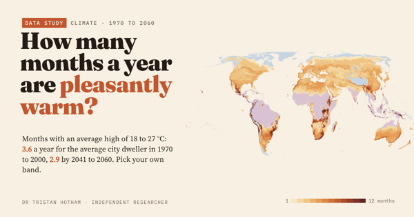
Months with afternoon highs of 18 to 27 °C: the average city dweller gets 3.6 a year now and 2.9 by 2041 to 2060. Pick your own band.
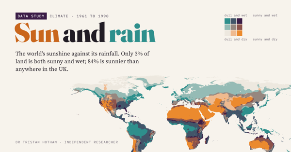
The world's sunshine against its rainfall: only 3% of land is both sunny and wet, and 84% is sunnier than anywhere in the UK.
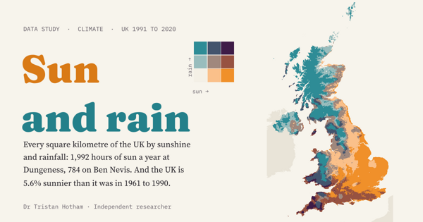
Every square kilometre of the UK by sunshine and rainfall at once. Since 1961 to 1990 the country has become 5.6% sunnier and 7.2% wetter.
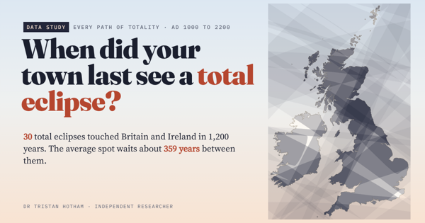
Every path of totality across Britain and Ireland from AD 1000 to 2200, tested for 17,103 places: for most towns the last was in 1715 or 1724.
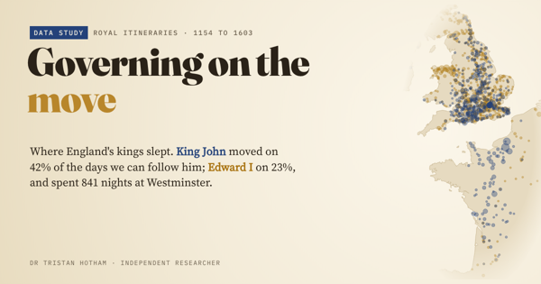
King John and Edward I mapped night by night: John moved on 42% of the days we can follow him, Edward on 23%.
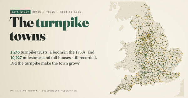
England's 1,245 turnpike trusts and 10,927 surviving milestones and toll houses: did the towns on the turnpikes grow faster? Not that the data show.
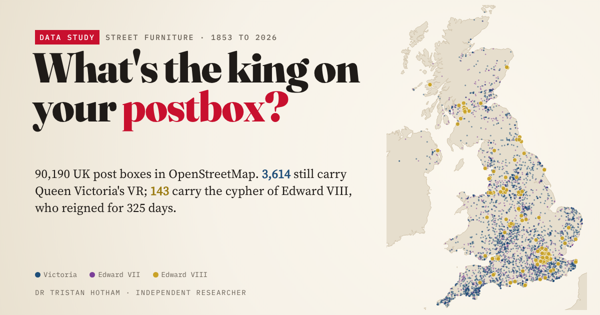
The royal cypher on 61,435 UK post boxes: 3,614 still carry Victoria's VR and 143 Edward VIII's.
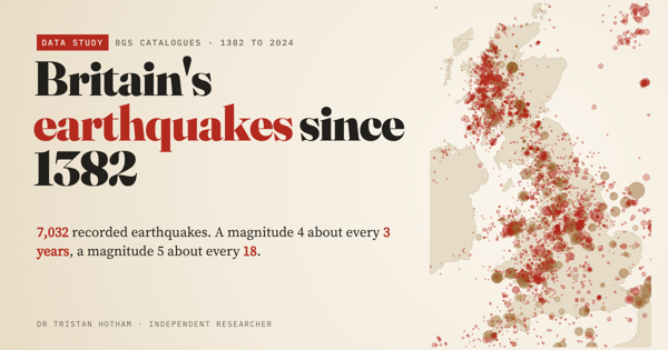
All 7,032 quakes in the BGS catalogues: a magnitude 4 about every 3 years, and the busiest modern zones were coalfields.
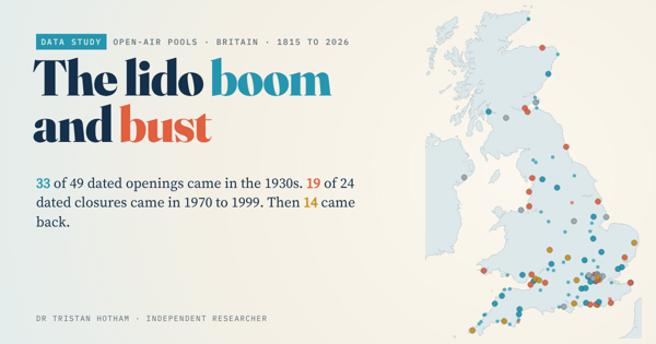
An open register of 73 British lidos: 33 of 49 dated openings came in the 1930s, and 14 closed pools have reopened.
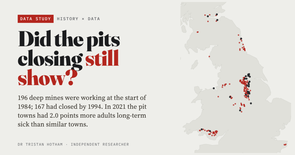
167 of 196 deep mines closed between 1984 and 1994. Forty years on, pit towns have 2.0 points more adults long-term sick than similar towns.
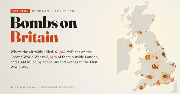
All 61,542 civilians on the CWGC's Second World War roll for the UK, town by town: 51% died outside London.
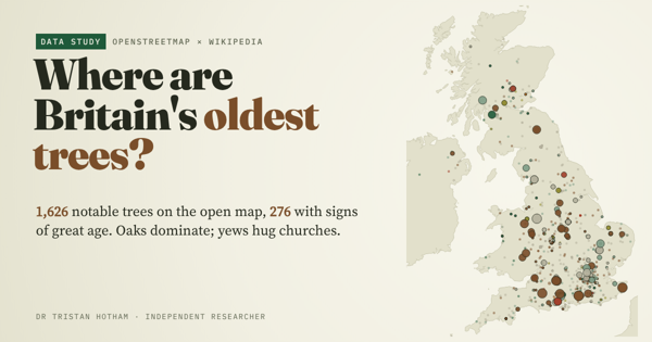
1,626 notable trees on OpenStreetMap: oaks dominate, yews hug the old churches, and giants stand in the royal forests.
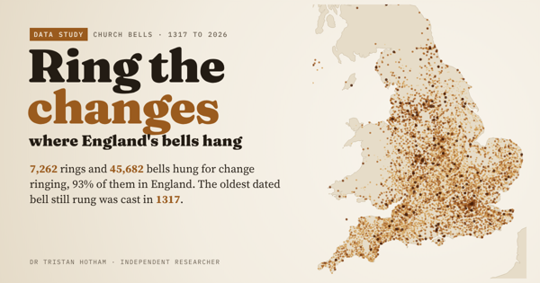
All 7,262 rings of change-ringing bells in Dove's Guide, mapped: jubilees, world wars and seven centuries of bell founding.
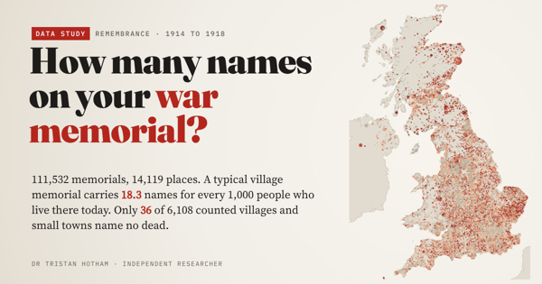
First World War names on 14,119 community memorials: 18.3 for every 1,000 people living there today, and only 36 small places record no dead.
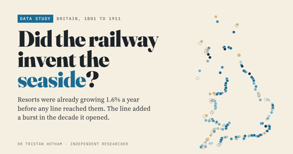
Britain's resorts were already growing 1.6% a year before the railway came. The line brought a burst in its first decade.
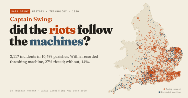
3,117 Swing riot incidents of 1830: parishes with a threshing machine were twice as likely to riot, but 90% of riotous parishes had none.
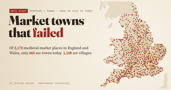
All 2,173 medieval market places in England and Wales, followed to today: 665 are towns, 1,168 villages, and a few are fields or sea.
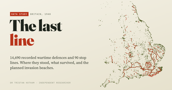
14,690 pillboxes and defences of 1940: the planned German landing beaches had 2.3 times the average density.
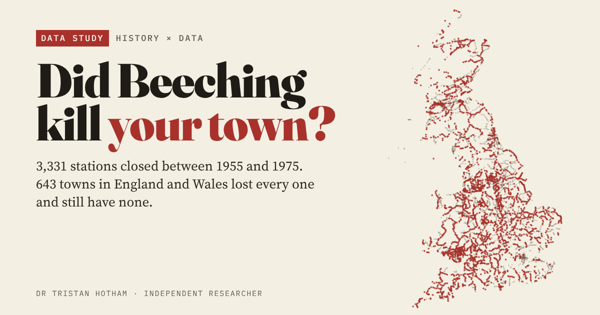
3,331 stations closed from 1955 to 1975, and 643 towns lost every one. They are a little poorer and more car-bound today, but did not fall off a cliff.
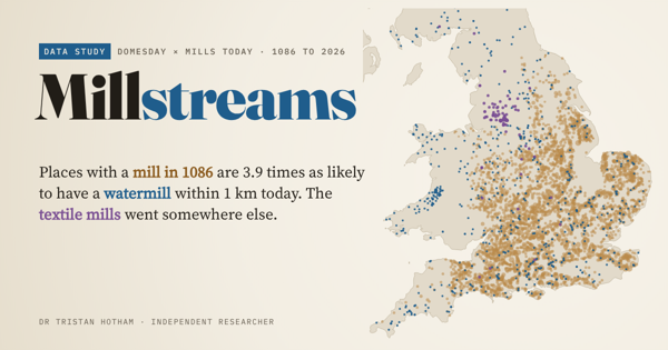
6,172 mills in Domesday Book: places that had one are 3.9 times as likely to have a watermill nearby today, but not a windmill.
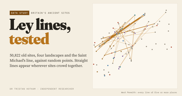
50,822 churches, barrows, stones, hillforts and wells against random points: crowding, not planning, explains the leys.
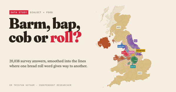
20,038 dialect survey answers mapped into Britain's bread roll lines, checked against the high street.
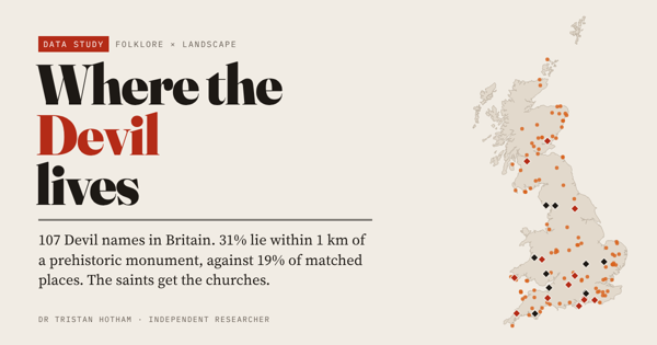
107 Devil place names in Britain: 31% lie within 1 km of a prehistoric monument, against 19% of comparable places.
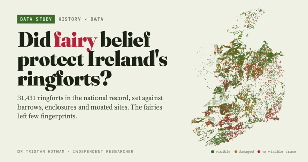
31,431 ringforts set against barrows, enclosures and moated sites: the fairies left few fingerprints.
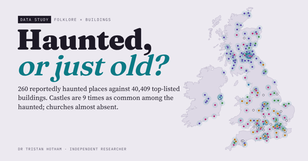
260 reportedly haunted places against 40,409 top listed buildings: castles and inns are 9 times as common among them, churches almost vanish.
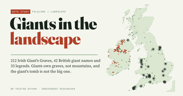
331 giant places in Britain and Ireland: giants own graves, not mountains.
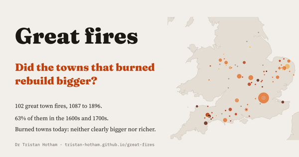
102 great town fires, 63% of them in the 1600s and 1700s: did the towns that burned rebuild bigger? Not clearly.
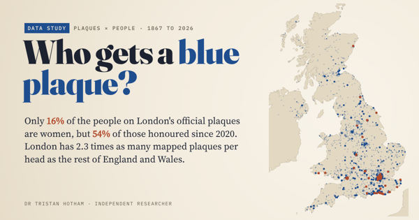
6,476 plaques across the UK and all 1,037 English Heritage plaques in London: 16% honour women, but 54% of those since 2020.
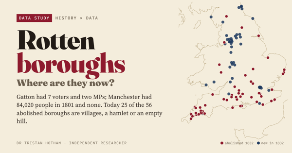
The 56 boroughs the 1832 Reform Act abolished, followed to today: 25 are villages, a hamlet or an empty hill.
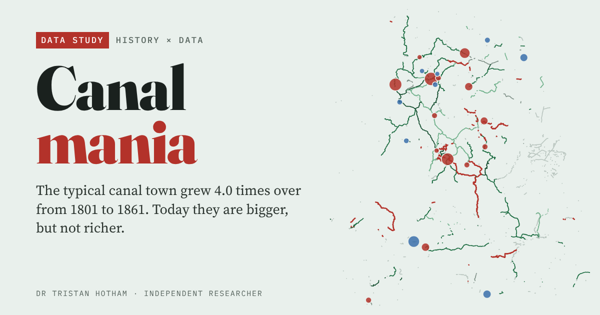
Did England's canal towns boom, and do they still lead? Bigger today, not richer.
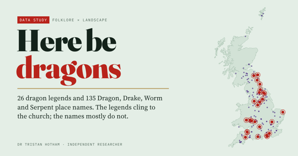
Britain's dragon legends and place names: they cling to the parish church, not the barrow or the river.
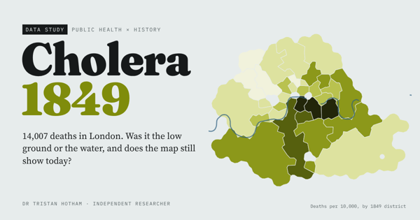
Farr's elevation law, Snow's pump and whether London's worst-hit districts are still the poorest.
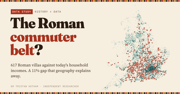
617 Roman villas against today's household income: a premium that is almost all geography.
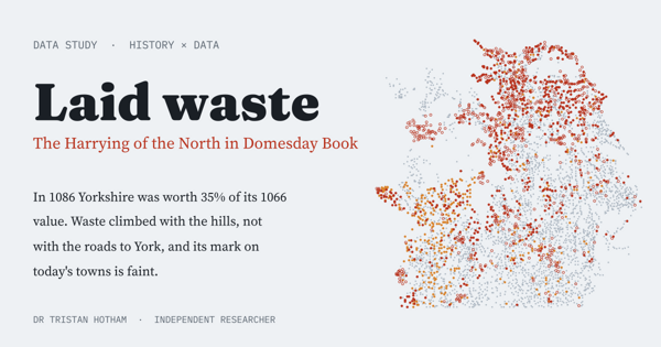
Where Domesday's 'waste' fell after 1069 to 1070, and how faint its scar is today.
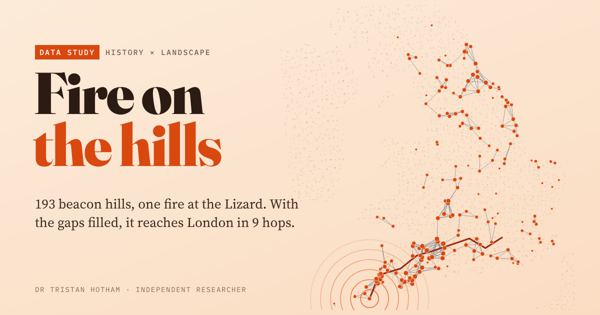
Could the Armada beacons carry the news? 193 beacon hills and the lines of sight between them.
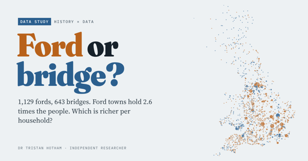
Every ford and bridge place name in Britain against the census and income: Oxford waded, Cambridge built.
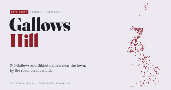
Where Britain put its gallows: 340 names measured for height, roads, towns and boundaries.
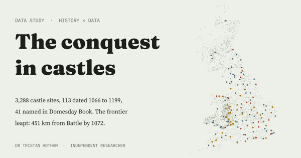
How fast Norman castles spread across Britain after Hastings, decade by decade.
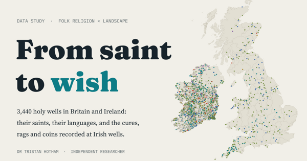
3,440 holy and wishing wells in Britain and Ireland: their saints, languages, cures and offerings.
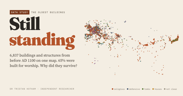
6,837 buildings from before AD 1100 on one map, and what kept them standing.
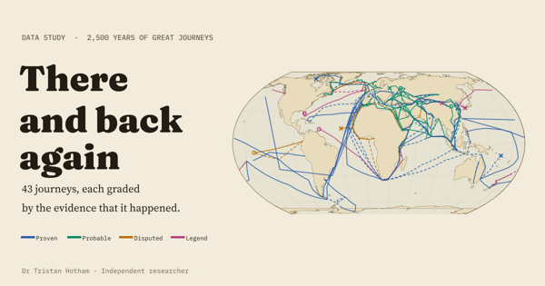
43 great journeys from 600 BC to 1947, mapped and graded by the evidence that they happened.
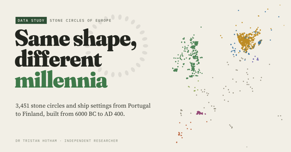
Every stone circle in Europe's open data, sorted into traditions and dated.
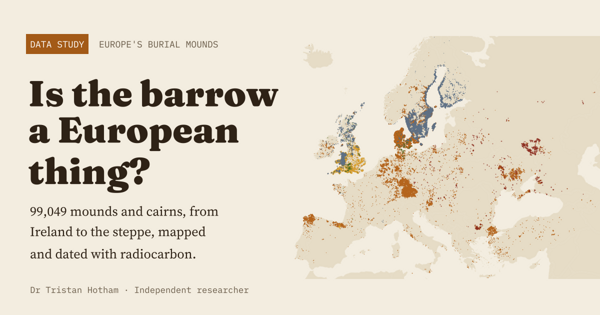
99,049 burial mounds from Ireland to the steppe, with radiocarbon dates.
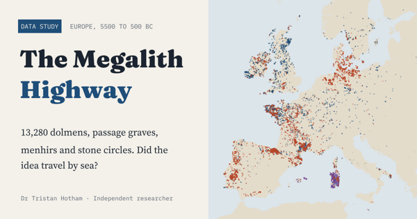
13,280 megalithic monuments: did the idea of the great stone tomb travel by sea?
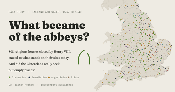
808 houses Henry VIII closed, traced to what stands on their sites today.
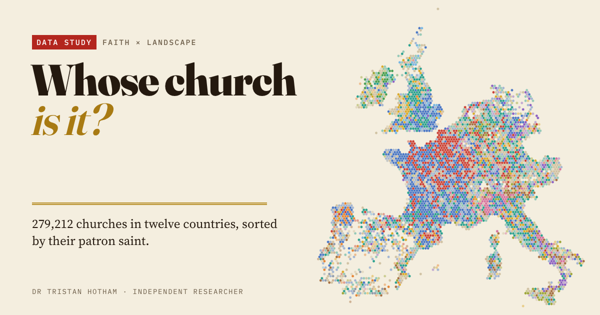
279,212 churches in twelve Western European countries, sorted by patron saint.
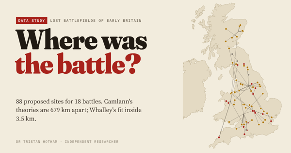
88 proposed sites for 18 lost battles of early Britain, scored against the texts.
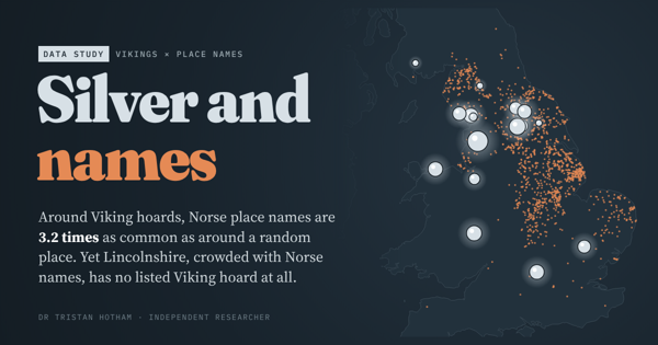
Viking hoards against Norse place names: they mostly agree, except in Lincolnshire.
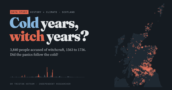
Scotland's 3,840 accused witches: did the panics follow cold years? They did not.
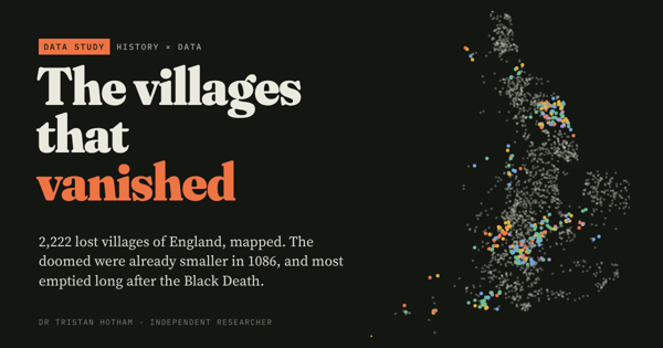
England's 2,222 deserted medieval villages against Domesday Book.
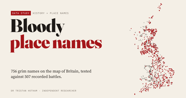
756 grim names on the OS map against 507 battles: only the Battles mark battlefields.
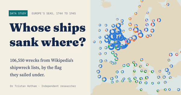
106,550 shipwrecks in Europe's seas, 1744 to 1945, by the flag they sailed under.
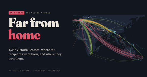
Where each Victoria Cross was won, where its recipient was born, and the distance between.
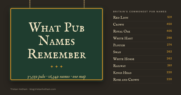
Every named pub in Britain, grouped and mapped: Red Lions, Royal Oaks and the names that give a county away.
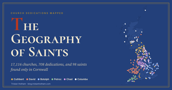
17,116 church dedications mapped: Andrew in Scotland, David in Wales, and 98 saints found only in Cornwall.
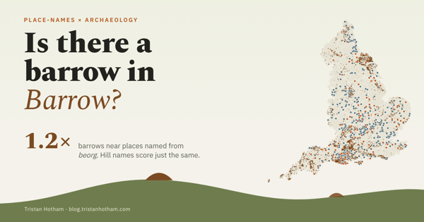
Do places named from Old English beorg sit by burial mounds? 129 names against 6,100 scheduled barrows.
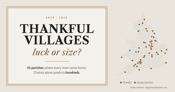
The parishes where every man came home from the First World War. Small helps, but chance predicts hundreds more.
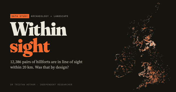
Could Britain and Ireland's 4,147 hillforts see each other? A line-of-sight network across two islands.
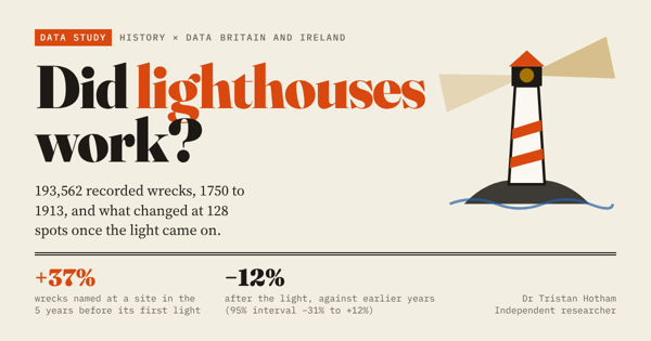
Shipwrecks before and after the lights were lit on the British and Irish coast, 1700 to 1945.
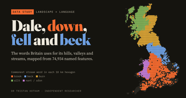
Walk north and the water changes its name. The words Britain uses for hills, valleys and streams, mapped.
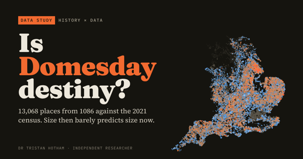
Does a place's size in 1086 still predict its size today? 13,000 Domesday places on one map.
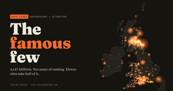
4,147 hillforts, ten years of Wikipedia reading. Eleven sites take half of it, mostly for their castles.
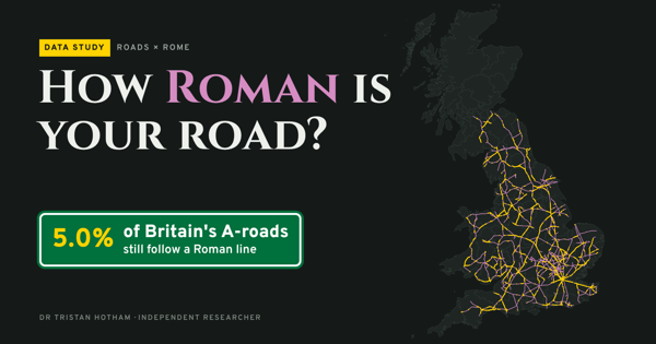
How much of each county's A-road network still follows a Roman line, with a lidar layer.
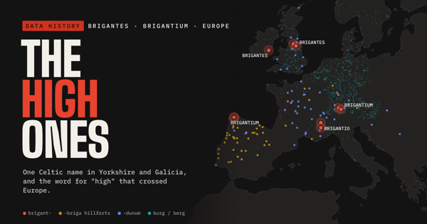
The Brigantes, Brigantium and the Celtic word for high, traced across Europe.
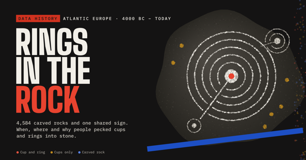
Cup-and-ring carvings on Europe's Atlantic edge: where they are, when, and what they might mean.
How an ancient triple spiral became a modern Celtic badge, 3500 BC to today.
UK searches and Portable Antiquities Scheme finds, 2004 to 2026: did a sitcom send people out with metal detectors?
No studies match that search.
Alongside the maps I write papers on parties, leaders and campaigns online. Every one is open, in the research hub.
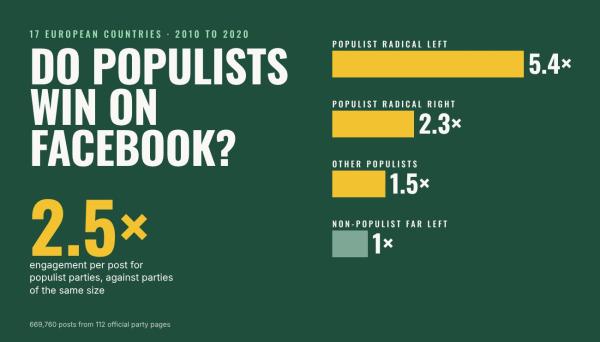
A typical post by a populist party received about 2.5 times as many likes, comments, shares and reactions as a post by another party of the same size and government status.
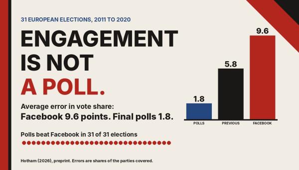
As a forecast on its own, engagement was poor: its mean absolute error was 9.6 points, against 1.8 points for the final polls.
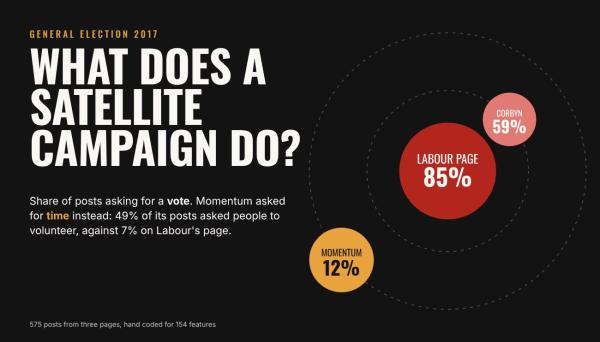
Momentum asked for a vote in 12% of posts. Instead about half its posts asked people to help on the doorstep, volunteer or sign up to campaign.
Participation was very unequal: the most active 1% of 1.1 million commenters wrote 31% of the comments.